October 12, 2015. Devin and the Center for Urban Habitats have completed their report of discoveries at the quarries.
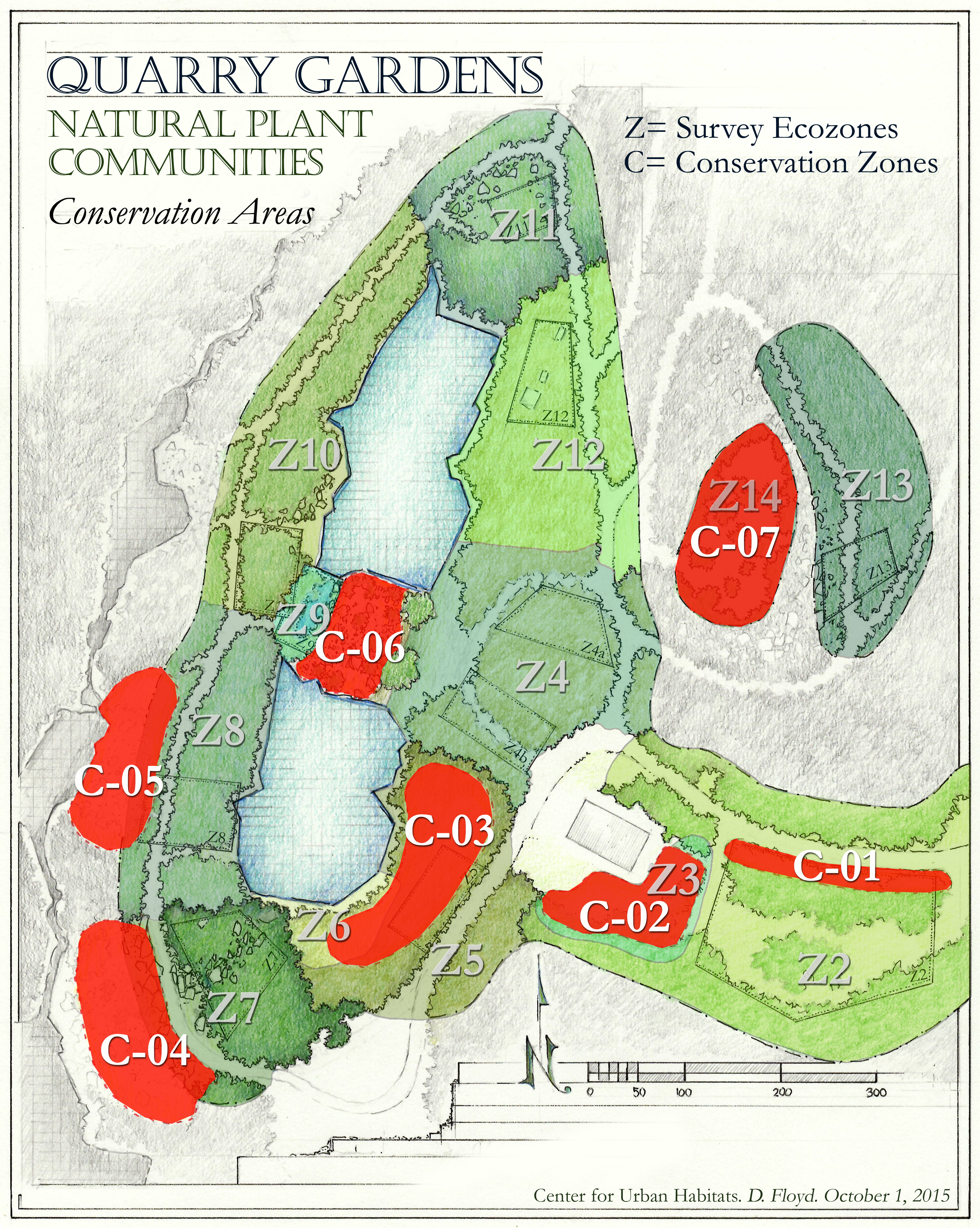
In 107 pages, the report includes notes on geology and descriptions of 14 ecozones and 7 conservation zones, along with lists and counts of plants, insects, birds, and animals. The map here shows the placement of natural plant communities around the two quarry pools and the visitor area to be developed. (Here’s the map again, a little larger.)

The survey has been ongoing since late spring. Its findings and recommendations have been informing our work right along, as trail routes were decided and the endless task of rooting out invasives begun. But it’s good to have it in hand–the natural foundation on which we will continue to build.
In the spring, we will want to complete the “as found” story with an inventory of early ephemerals missed this year. In the meantime, design of the gardens to be integrated into these zones continues. And planting is underway.
Happy that the heavy rains associated with last week’s tropical storm-hurricane Joachim scenario failed to dislodge the first of seven thousand or so plugs installed only days before to start a meadow in the disturbed area below the overlook platform, in what we now know as “Ecozone Zone 6: South Bryophyte Flat.”